Fersfield AirfieldRAF Fersfield · USAAF Station 554 · Norfolk

Documents and maps

Maps, plans and papers connected with Fersfield. Tap any picture to see it full size.

German Luftwaffe map of the half completed airfield
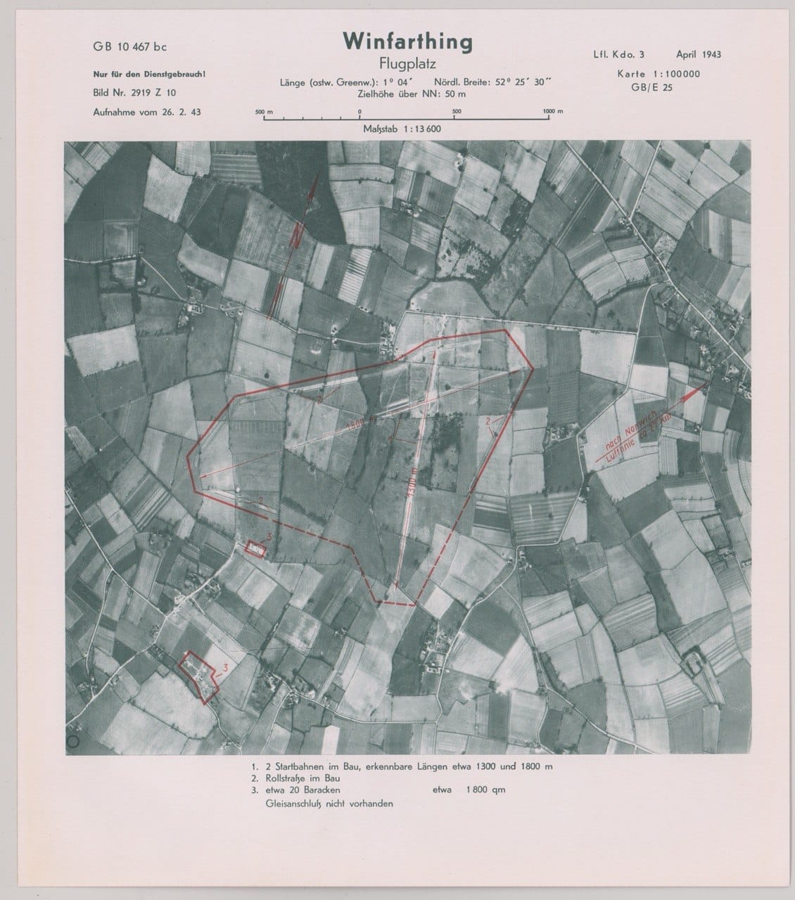
German aerial reconnaissance map titled Winfarthing Flugplatz, a black and white aerial photograph of fields with the half-built runways and huts outlined and numbered in red, with typed German notes above and below

Titled "Winfarthing Flugplatz" and dated April 1943, made from an aerial photograph taken on 26 February 1943.

Credit: Luftwaffe · Open full size

Do you have a document, map or letter connected with Fersfield? We'd love to see it. Get in touch.

See also: photographs and the timeline.